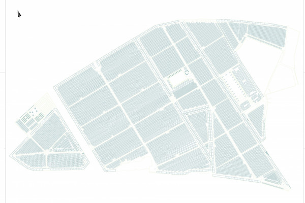
Datenerfassung für das Friedhofs-GIS / Data collection for the cemetery GIS
Cora Stöger
Der St. Barbara-Friedhof in Linz hat ein neues GIS-System zur Verwaltung aller Daten angeschafft. Um den räumlichen Bezug herstellen zu können, mussten sämtliche Grabstellen, Urnengräber, Gruften und Stelen erfasst werden, ebenso wie die Fußwege, Wasserentnahmestellen, Müllentsorgung und Vegetation. Aufgabe war für den gesamten Friedhofsbereich die flächendeckende Erfassung aller räumlichen Daten und entsprechende Aufbereitung für das GIS-System.
The St. Barbara cemetery in Linz established a new GIS-system for management of all data. To give the spatial reference to all these data, surveying of all grave sites, urn graves, tombs and central cylinders was necessary as well as collecting spatial data of footpaths, water intake and waste points and vegetation. For the whole area of the cemetery the spatial data of all those had to be collected and processed for importing them into the GIS-system.
Client: St. Barbara Gottesackerstiftung
Categories: Service and Administration
Project Gallery

3897_Bestand_gesamt_Plan.jpg

Cora Stöger AT
http://www.geounit.at
Klammstraße 9 | 4209 Engerwitzdorf